


GERMAN TWP Voting District, Kossuth County, Iowa
About
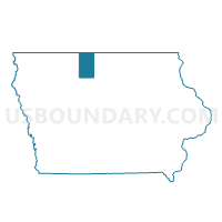
Outline

Summary
| Unique Area Identifier | 582575 |
| Name | GERMAN TWP Voting District |
| County | Kossuth County |
| State | Iowa |
| Area (square miles) | 35.66 |
| Land Area (square miles) | 35.66 |
| Water Area (square miles) | 0.00 |
| % of Land Area | 100.00 |
| % of Water Area | 0.00 |
| Latitude of the Internal Point | 43.29876190 |
| Longtitude of the Internal Point | -94.02953090 |
Maps


Graphs
Select a template below for downloading or customizing gragh for GERMAN TWP Voting District, Kossuth County, Iowa


Neighbors
Neighoring Voting District (by Name) Neighboring Voting District on the Map
- BINGHAM TWP Voting District, Hancock County, IA
- BUFFALO TWP Voting District, Kossuth County, IA
- BUFFALO TWP Voting District, Winnebago County, IA
- GRANT TWP Voting District, Winnebago County, IA
- LEDYARD TWP W/O LAKOTA Voting District, Kossuth County, IA
- LINCOLN TWP Voting District, Kossuth County, IA
- PORTLAND TWP Voting District, Kossuth County, IA
- RAMSEY TWP Voting District, Kossuth County, IA
Top 10 Neighboring County Subdivision (by Population) Neighboring County Subdivision on the Map
- Buffalo township, Winnebago County, IA (1,106)
- Buffalo township, Kossuth County, IA (685)
- Ledyard township, Kossuth County, IA (547)
- Bingham township, Hancock County, IA (426)
- German township, Kossuth County, IA (188)
- Portland township, Kossuth County, IA (178)
- Ramsey township, Kossuth County, IA (170)
- Grant township, Winnebago County, IA (148)
- Lincoln township, Kossuth County, IA (146)
Top 10 Neighboring Unified School District (by Population) Neighboring Unified School District on the Map
- North Iowa Community School District, IA (3,210)
- Titonka Consolidated School District, IA (1,017)
- Woden-Crystal Lake Community School District, IA (912)
Top 10 Neighboring State Legislative District Lower Chamber (by Population) Neighboring State Legislative District Lower Chamber on the Map
Top 10 Neighboring State Legislative District Upper Chamber (by Population) Neighboring State Legislative District Upper Chamber on the Map
Top 10 Neighboring 111th Congressional District (by Population) Neighboring 111th Congressional District on the Map
Top 10 Neighboring Census Tract (by Population) Neighboring Census Tract on the Map
- Census Tract 6802, Winnebago County, IA (2,742)
- Census Tract 9502, Kossuth County, IA (2,541)
- Census Tract 9501, Kossuth County, IA (2,424)
- Census Tract 2704, Hancock County, IA (2,189)